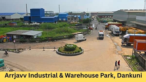










Dhulagarh has the sound and speed of a real logistics belt. By morning, the area around Dhulagori, Bombay Road, NH-16, Sankrail, Salap, Panchla and Howrah-side routes starts moving with trucks, warehouse staff, loaders, buses, autos, goods carriers and business visitors. This is not a normal office location. It is a warehouse-heavy industrial zone where highway access, loading space, truck movement and last-mile transport matter the most.
Dhulagarh Industrial Park is best understood as part of the wider Dhulagarh-Dhulagori warehouse and industrial belt in Howrah. The area is useful for logistics companies, manufacturers, distributors, storage operators, e-commerce supply chains, transporters, vendors and business visitors who need access to Kolkata, Howrah, Kharagpur, Haldia, Hooghly and other eastern India markets.
Dhulagarh Industrial Park Quick Overview
| Details | Information |
| Name | Dhulagarh Industrial Park |
| City | Howrah |
| State | West Bengal |
| Main Location Belt | Dhulagarh / Dhulagori / NH-16 / Bombay Road side |
| Property Type | Industrial Park / Warehouse / Logistics Belt |
| Useful For | Warehousing, storage, distribution, dispatch, manufacturing support |
| Main Road Access | NH-16, Bombay Road, Dhulagarh Toll Plaza, Salap, Sankrail, Panchla side |
| Nearby Railway Access | Santragachi, Andul, Maurigram, Howrah Station side |
| Nearby Bus Access | Dhulagori Bus Stand, local Howrah-Dhulagarh routes |
| Airport Access | Netaji Subhas Chandra Bose International Airport, Kolkata |
| Nearby Areas | Dhulagori, Sankrail, Salap, Domjur, Panchla, Andul, Santragachi |
| Nearby Facilities | Warehouses, weigh bridges, petrol pumps, dhabas, banks, transport offices, local shops |
Where is Dhulagarh Industrial Park Located?
Dhulagarh Industrial Park is connected with the Dhulagarh-Dhulagori side of Howrah, close to Bombay Road and the NH-16 logistics corridor. Property listings for warehouses in the area mention Bombay Road, Dhulagarh, and nearby transport points such as Dhulagori Bus Stand, Indian Oil, weigh bridges and Dhulagarh Toll Plaza.
For map search, visitors can use “Dhulagarh Industrial Park Howrah,” “Dhulagori Industrial Park,” “Dhulagarh warehouse,” “Dhulagarh Toll Plaza warehouse,” or the exact company/unit name. Since this is a large industrial belt with many separate warehouses and sheds, visitors should confirm the exact gate, warehouse number, unit name, loading point and map pin before starting.
Why This Location is Important
The biggest advantage of Dhulagarh is its logistics position. The area is close to NH-16, one of India’s major highway corridors running between Kolkata and Chennai through important eastern and southern states.
For warehouse operators, this location is useful because goods can move towards Kolkata, Howrah, Kharagpur, Haldia, Odisha, Jharkhand and other nearby markets. For businesses, it offers a practical base outside the most crowded parts of Kolkata while still staying connected with the city’s consumption and distribution network.
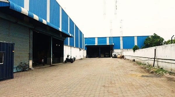
Dhulagarh also has multiple warehouse listings, including large PEB warehouse spaces. One listing near Dhulagarh Toll Tax mentions a 1,45,000 sq. ft. warehouse with PEB structure, dock-level floor height, ample parking, fire compliance and NH-16 around 4.72 km away.
Road Connectivity to Dhulagarh Industrial Park
Road connectivity is the strongest point of Dhulagarh Industrial Park. The main access comes through NH-16, Bombay Road, Dhulagarh Toll Plaza, Salap, Sankrail, Panchla, Domjur and Kona Expressway-side routes.
People coming from Kolkata usually travel through Vidyasagar Setu, Kona Expressway, Santragachi and NH-16 side routes. Visitors from Howrah Station can move towards Santragachi, Andul, Sankrail or Dhulagarh depending on traffic. From Kharagpur, Kolaghat or Haldia side, NH-16 is the main approach.
Since this is a truck-heavy belt, travel time can change during loading hours, market hours and highway congestion. Visitors going for warehouse inspection, vendor meetings or dispatch work should keep extra time for truck queues, gate entry, parking and internal road movement.
Railway Connectivity
Railway connectivity is useful for staff and business visitors. The practical railway references are Santragachi, Andul, Maurigram and Howrah Station, depending on the exact warehouse location and route.
Howrah Station is the main long-distance railway hub for visitors coming from other cities. It is one of India’s major railway stations and connects with both Eastern Railway and South Eastern Railway routes. From Howrah Station, visitors can take a cab towards Dhulagarh through Santragachi and NH-16-side roads.
For local movement, Santragachi, Andul and Maurigram may be more practical depending on the warehouse gate and transport availability.
Bus and Local Transport Connectivity
Bus and shared transport are available around Dhulagori, Salap, Sankrail and Howrah-side routes. Property listings for the area mention Dhulagori Bus Stand as a nearby transport point, along with Indian Oil, weigh bridges and the Dhulagarh Toll Plaza.
For daily workers, buses and shared vehicles can be useful if the stop is close to the unit. For first-time visitors, a cab from Howrah Station, Santragachi or Kolkata side is usually easier because warehouse gates may be located inside industrial lanes.
Metro Connectivity
Metro is not the main travel option for Dhulagarh. Kolkata Metro’s Green Line now serves Howrah Maidan and connects Howrah with the Kolkata side, but Dhulagarh still needs a road-based final journey from the metro or railway side.
For practical travel, visitors should plan around road, rail, bus, cab or company transport rather than metro-only access.
Airport Connectivity
The nearest major airport is Netaji Subhas Chandra Bose International Airport in Kolkata. It serves the Kolkata metropolitan region and is located in Dum Dum.
From the airport, business visitors can take a cab through Kolkata city roads, Vidyasagar Setu, Kona Expressway and NH-16-side routes. Travel time can increase during peak traffic, rain, truck movement and highway congestion.
Nearby Landmarks and Facilities
Nearby references include Dhulagarh Toll Plaza, Dhulagori Bus Stand, Bombay Road, NH-16, Sankrail, Salap, Panchla, Andul and Santragachi. The area has warehouses, weigh bridges, petrol pumps, dhabas, transport offices, banks, local shops, repair services and truck movement points.
For first-time visitors, the safest approach is to confirm the exact company name, warehouse number, gate, loading point and map pin before starting. Dhulagarh is well connected for industrial work, but the final few minutes can change because of truck traffic, internal roads, security entry and warehouse activity.